Its 9 years since we were last in Cusco, and everything looked and felt familiar, although we don't remember it being as cold as it was. We decided not to revisit Macchu Pichu, but we did look at some of the sites again...
We took another look at the Qoricancha, the inca holy of holies, and this is interesting because of the quality of the masonry,..
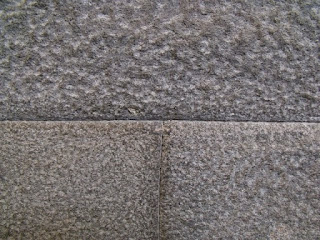 |
| ...you really can not insert a piece of paper into the joints... |
|
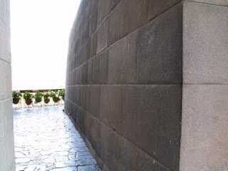 |
| ...and those joints extend along the entire length of the walls, with no cement or jointing, just andeasite blocks interlocked together with precision... |
|
 |
| This small block is only 1cm squarish but passes through the width of the wall about 50cms...why ? no one knows... |
|
The Qoricancha is where the Inca (the king, and his high priests would perform the most sacred of rites)and some of the rooms would have been covered with gold; in fact the quechua word Qoricancha means place of gold. The Inca attached no value to gold apart from its appeal for decoration. This is unlike the Spanish conquerors who stripped the Inca Empire for every ounce of this metal they could get. All that remians today is the Andeasite blocks so intricately laid together, that it was easier for the Spanish Franciscan monks to incorporate it completly into the monastry they built on it than to take it apart
We also visited Pisac, famous for its handicraft market, but we really went to see the Inca ruins...
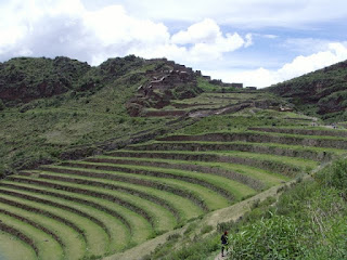 |
| Field terracing, and buildings in the distance. |
|
And Ollantaytambo, where the Incas held out against the Spaniards, but were eventually defeated, and forced to retreat to Vilcabamba...
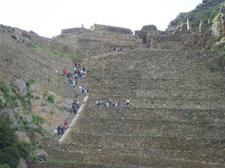 |
| Ollantaytambo, terracing on the steep hillside, with the "fortress" above... |
Whilst in Peru we took a fews days trip into the Manu National Park. What no Inca ruins I hear you say, no steep terraced fields and fortress buildings perched impossibly atop precipitous mountains. No this is pristine rain forrest pure and simple
Manu
We'd never heard of Manu before looking at our sabbatical year and where to go. It is quite remote, with one road in and one road out, and takes a full day of travelling to reach the outer limits of the National Park. But once there the memories of the tough journey slip away.
Our journey started in Cusco at 0500hrs and a drive south to pick up a new tar road to Paucartambo. This is a new road still under construction, being cut into the face of the mountainside., but after an hour and a half we saw bus loads of people walking on the road. There had been a landlside further up which took out 500 metres of the newly cut road. We had to turn around and head back towards Cusco and pick up the only alternative road to Paucartambo, through Pisac. So three hours after setting off, we actually set off.....
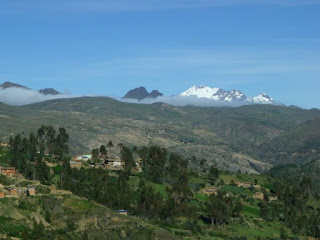
Despite the delay we were spoiled by the landscape...
 |
| This is just above Pisac on the good bit of road to Paucartambo...you can just see the hairpins in the distance below... |
|
 |
| ...and a bit further on, it was so cold we could not feel our fingers.....cos there was snow on the Andes!!!! | | |
|
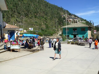
At the end of this part of our journey was Paucartambo, a Spanish colonial town established as a base for the search for El Dorado...
 |
| This is the main square with statues to symbolise the different regional dances.. |
|
 |
| Main street, just outside the main market... |
|
After this the road surface got a little rougher in texture, and steeper as we descend from the Andes to the lower levels of the rain forrest.
From the high Andes we descend through several ecologically distinct zones, Puna (low lying shrub), Elfin forrest, Cloud forrest, Rain forrest and then jungle.
 |
| Compacted gravel road... between 4 and 5 metres wide.... |
|
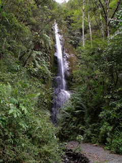 |
But depite the journey there are some pretty sites to see....like cascades... | |
|
 |
| ...one of the locals hitched a lift.... |
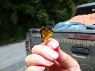
In fact there were butterflies on the road and in the air every time we stopped...
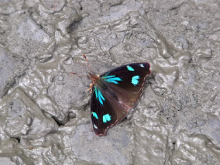 |
| ...Some Blue... |
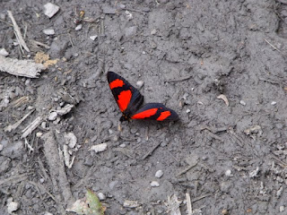 |
| ...Some red... |
 |
| ..oh and not to mention the quetzals... |
..and of course the cloud and rain forrest that is home to all of the above and more.
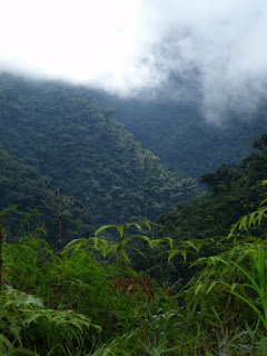 |
| ...this is the view of the cloud forrest from the single track road (there are the occasional passing places)... |
At the end of our road is ....
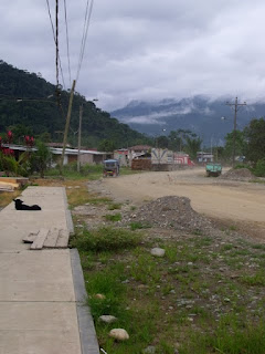 |
| ...Pilcopata....believe us its busier than it looks... |
The following day we had to drive to Atallaya to take a boat, but first we had to help a truck otu of a rut...
 |
| ...there is a 200 metre drop on the right...this little mishap delayed us for an hour and kept us from... |
|
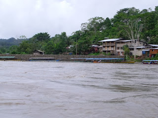 |
| Atallaya "port"...on the Upper Madre de Dios river |
|
and our ongoing...
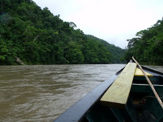 |
| journey down river.... |
|
|
An hour later and we were in our lodge. here we spent the next two days spotting loads of wildlife, but mostly birds, the most interesting of which was....
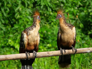 |
| ..the Hoatzin... |
These birds eat a diet of toxic leaves and have evolved as ruminants to help them digest their odd diet,kinda funny looking too! (other ruminants for example are cows, who have 4 stomachs to digest plants). They don't appear to have any distinctive song either apart from very heavy breathing.
We also saw some cute squirrel monkeys and a white caiman on a night walk, as well as....
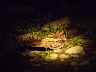 |
| ..a nightjar resting on the trail... |
|
Our 5 days in Manu flew by especially when 2 days were needed for the drive in and out, but we wouldn't have missed it, the scenery is stunning and the wildlife even more so....
Thanks to Fredy (our guide), Chistian (our driver) Carlos (the boatman) and Fredys mum (our cook).you can contact Fredy directly on
www.greenlandperu.com
As ever we had to move on and our next destination is Puno, on the shores of lake Titicaca.


